The Inca Trail is a 4-day 45-km long trek leading to Machu Picchu, which we hiked during our two-week trip to Peru. The access to the hike is regulated by the Peruvian government and entries are limited to 500 per day, agency staff included. You can access the hike only by booking with a licensed agency which will request the entry permit on your behalf. In this article we will outline this unique experience day by day, describing the Inca ruins as well as the feelings that we experienced walking through the jungle. If you need practical tips on the Inca Trail, on for instance how to choose the right agency, what to bring with you, how to prepare yourself etc., do not forget to read our article on Inca Trail FAQs.
We booked the hike with an agency called Alpaca Expeditions and the adventure began the evening before our departure.
Table of Contents
Day 0
We met at 6:30 pm at the headquarters of the agency in Cusco city centre. During this first meeting we got to briefly meet the other guys of our group and our guides: Javier and Wilbert. During the meeting, they gave us a green duffel bag which we had to fill with clothes and what we needed for the trip: remember that the sleeping bag and pillow must fit in this duffel bag which should not weigh more than 7kg, since a staff member will carry it during the day. They also gave us a cover for our backpack and a raincoat - everything in green, the colour of the agency. After having checked whether there were vegetarian people, the guides organised the bus pick-up for the next morning. We were going to be the last ones to be picked up at 4:15 am. At the end of the meeting, we stopped by the supermarket to buy toilet paper, water and some snacks and went back to the hotel to make our bag, thrilled and a little anxious for this new adventure awaiting!
Day 1
The bus of our agency came to pick us up as agreed and after one hour and a half, we reached the porter house, i.e. the house where porters (people carrying material on the hike) sleep the night before departure. We had breakfast and we left for km 82, close to the city of Ollantaytambo, which is the beginning point of the Inca Trail.

At km 82 there was the first checkpoint where authorities checked our passport and entry permit. There are other check-points all along the hike. We spent an hour there organising bags; our duffels bags were weighed and given to a staff member; tends and food were also split between the porters’ bags.
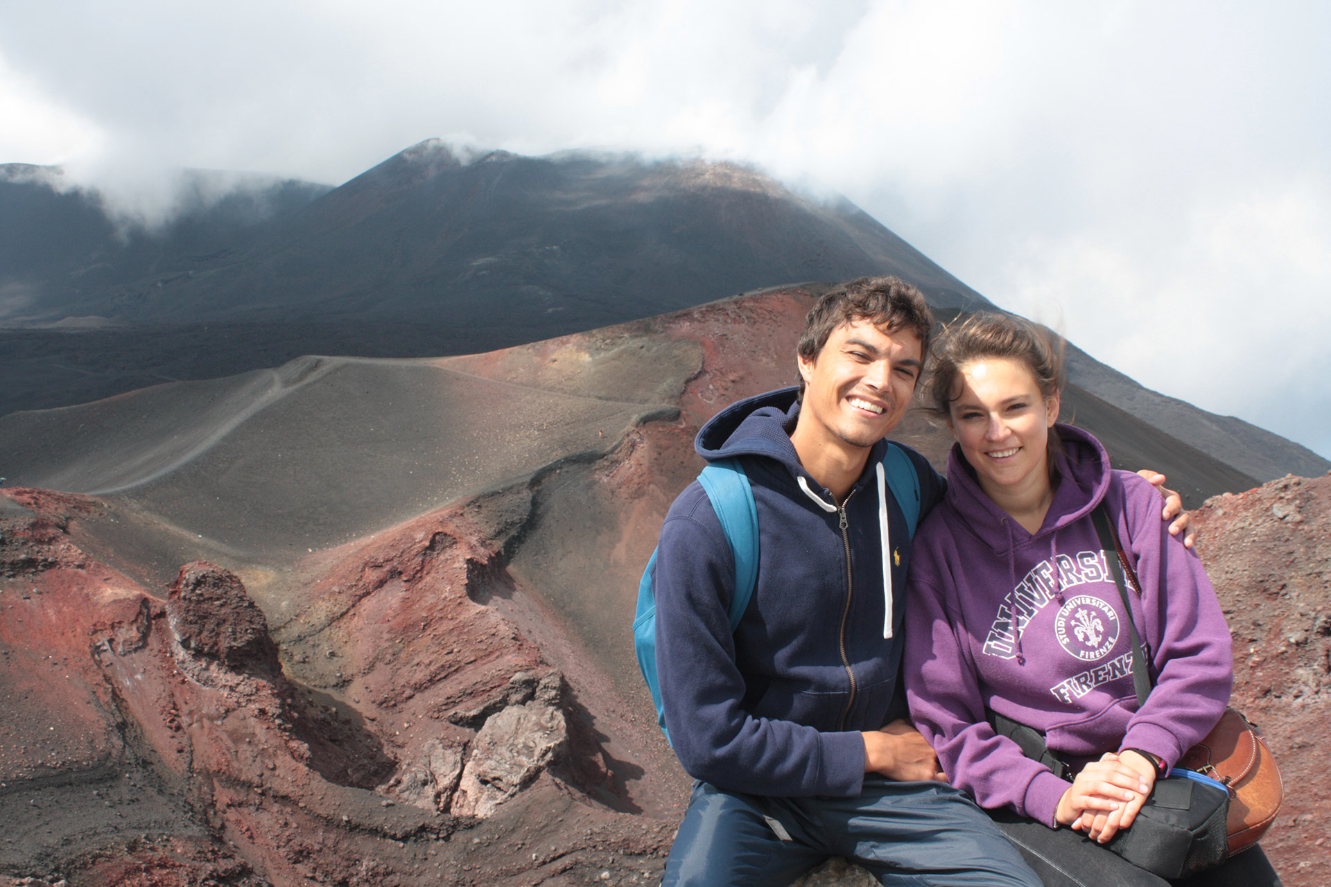
We quickly passed through an information centre, where our guide explained the type of flora and fauna that we could meet along the way and then we took the iconic photo under the signpost indicating the beginning of the Inca Trail.

The hike of the first day was considered an average difficult hike. We had to walk 14km altogether in 5 hours and half. The hike alternated uphill and downhill, because, like our guide told us, the Inca Trail only consists in the so-called ‘Peruvian flat’, which is not flat at all. During the first hike day, we stumbled upon local people living on the first part of the track, which can also be walked by animals. Local people usually have little stands where they sell food and drinks and rent toilettes for 1 sol.

The road got a little steeper and we reached a wide area with a view on the underlying ruins of the Patallacta site, where we could see the typical terraces where Incas used to practice agriculture.


While admiring the view, our guide told us that in the Inca culture, mountains, called Apus, are considered deities, as well as Pachamama, mother earth. Looking around we could definitely feel the spirits of the majestic mountains surrounding us, which were going to accompany us during the whole trek. As a thanksgiving and good omen ritual, we offered them some coca leaves or the first mouthful of a meal, which we placed on the ground. Coca leaves are also considered sacred; your guide will give you some leaves to chew every day, because they help fight altitude sickness, and once you are finished chewing them, you need to lay them on the ground as a sign of respect, and not throw them away.

After the lunch break, we still had 2 hours and a half of hike to go, where we walked by two local communities. We also caught sight of some hummingbirds along the way; there are many hummingbirds along the Inca Trail, but it’s not easy to spot them, since they are very small and blend in with nature.


In the afternoon, we went through the second checkpoint, where we had to wait forty minutes for authorities to check our passports and entry permits.

At around 5 pm we reached the camp, right as it started raining. The tents had already been set up by staff members who were preparing the happy hour and dinner. Each couple of participants slept in green four-people tent and there was a bigger tent, divided into two areas, which contained the kitchen and a big table where we could eat together; a smaller tent located a little bit further away had a small chemical toilet. Upon arrival, staff members brought us a basin of lukewarm water with which we could wash ourselves.

We had some tea with coca leaves or tea with muña - Peruvian mint - which are both ideal to fight altitude sickness, with popcorn made from local corn for happy hour.

Then, we were served lots of different dishes for dinner; our chef cooked 6-7 typical Peruvian dishes each time, as well as some vegetarian dishes.

At 8pm we were already sleeping; the following day was going to be hard!
Day 2
Honestly speaking, this day was a bit worrying. The second day included 12 hours of trekking (visits and breaks included) to only hike 16km, because we had to reach the highest peak of the hike: the Dead Woman’s pass at 4,200m. It’s not called dead woman’s pass because a woman died there - even if when you will reach the top, you won’t feel the greatest - but because the mountains of the pass look like the profile of a woman lying down.
We left at 4:30 am under the pouring rain which was going to keep falling pretty much during the whole day. Our camp was located at 3,300m above sea level and we had to reach 4,200m of the pass, then we had to get down to 3,580m, get back up to 4,000m and then go back down once again to 3,600m where the second camp was located. During the first part of the ascent, we were completely plunged in the jungle and we climbed a lot of stairs little by little; the steps were not too steep and were pretty regular, though. We walked slowly, each to his/her own pace, enveloped by the silence of the jungle: we could only hear the endless clacking of rain which kept falling down, as well as the pounding of little streams which formed after the rain.

We were all wearing raincoats with different colours according to the agency, but we were spaced out and we hiked pretty much by ourselves in silence. Sometimes porters would overtake us; porters were born and lived their whole life in the mountains and are used to the lack of oxygen due to the altitude and, chewing coca leaves, walk pretty quickly.

Around half way up, we stopped at a hut, where some funny completely soaked llamas were nibbling away at the grass. It was cold, because we were wet and at this point, we were pretty high up in the mountain. We ate something and started walking again towards the peak.

We still had 40 minutes to go to reach the peak and now the path was open on the flank of the mountain. We could see the summit, but altitude started to kick in: our legs got heavier and our breath shorter, especially in the last 15 minutes.

We finally reached the peak: we had conquered the Dead Woman’s Pass, at last! Luckily, the rain stopped falling for a moment and we managed to rest for an hour. On one side, we could see the whole valley that we had just climbed. On the other side - a lot colder because it was exposed to the wind - we could see the descent waiting for us.


We were very satisfied with ourselves, but we were reminded very quickly of the harsh reality: we had only walked 4 out of the 12 total hours that the day entailed. After an hour-long break, we started walking again and it started raining again, too. We had to go down steep steps which the pouring rain made slippery. In an hour and a half, which seemed endless, we descended the Pacaymayu valley, e.g. the hidden river valley. Although the rain and fog were hiding a part of the view, we could see the immense valley and mountains facing us. The rain was feeding small streams crossing the path and falling down the valley. This part of the path was hard; we were starting to get tired, we were completely soaked and we had to walk down the steps carefully, because they were steep and slippery. We finally reached a camp, where we had lunch.

Starting to walk again after the lunch break was hard and we kept walking by inertia. It was time to face the second climb of the day to the second pass of the Inca Trail, Runkuracay, standing at 4,000m. The views during the first part of the path were breathtaking and the rain finally gave us a break. We climbed the mountain facing the one that we had climbed that same morning; from afar we could see the Dead Woman’s Pass, the descent and a beautiful waterfall falling down the mountain. Clouds covered parts of the mountains, creating a rather mystical view. From afar we could see the snow-clad Saltankay mountain - the destination of another famous hike.

On the way up, we stopped at the Runcu Raccay site plunged in the fog; this site was used as haven for pilgrims and messengers on the way to Machu Picchu to rest and eat.


After having passed the second peak called Runcuraccay, the path was now all downhill to the camp. We were pretty high up and we could admire some magnificent views on the third valley that we got to see on this very long day. Luckily enough, it wasn’t raining anymore and we walked in silence, interrupted only by some big drops falling down from above. We saw a lot of hummingbirds stretching their wings after the rain.


We were getting closer to our target; at that point, we were exhausted and we were only thinking about reaching the camp. Thirty minutes before arriving, we stumbled upon yet another Inca site called Sayacmarca or inaccessible village, perched on a little mountain. There were 50 steps to climb to reach the site entrance. We gathered the little energy we had left and climbed them. In this site priests used to adore the mountains - given the ideal position above the valley - and welcome tired pilgrims. This site developed over two floors; windows have holes where people could insert their hands to lift themselves up to the second floor, without needing any stairs.


It was after 6.30 pm and we walked the last 30 minutes on a flat path with our torches on, since the night had already fallen. We were very tired after 12 hours of intense hike, but we were extremely satisfied that we had made it. Staff was waiting for us at the beginning of the camp cheering us on, even though it should have been us applauding them for the incredible work they did. The camp had been set, dinner - as delicious and copious as always - was ready; we had dinner straight away and exhausted, we went to bed.

Day 3
Upon waking up, we realised that our camp was placed on top on a magnificent valley with a breathtaking view on the mountains.

Before leaving, each staff member introduced himself and so did we. It provided us the opportunity to meet the 18 staff members who accompanied us during the hike, carrying our bags, setting up camp and preparing food, as well as cleaning the path. We would have liked to share this moment on the first day of hike, rather than on the third one, so that we could have gotten to know them from the start.

The third day should have been the easiest day, but we soon realised that there were no truly easy days, but just days that were easier than others. However, the worst was definitely over. The third day was ‘only’ made of 5 hours of hike; the first hour and a half was more or less all flat.
The path was plunged in the jungle, also called cloud forest; cloud forests are humid evergreen forests often covered by low-medium clouds. After yesterday’s rain, trees were still dripping and the air was damp, while the forest was still enveloped in silence. We also crossed many small dark caves.


The path was sometimes narrow overhanging the valley, so we walked carefully. Since this day had less hiking hours, we had more time to enjoy the view. At one point, we started climbing back up to the third and last summit of the hike, Phuyupatamarka at 3,600m.


After having reached the peak, we still had three hours of descent to go, as per usual with steep steps. This was the most difficult part of the day, since the descent was very tiring for legs and knees. Luckily, the third day was full of sites to visit; we went through the Phuyupatamarka site (bearing the same name as the pass), i.e. the city in the clouds, which we saw from above first and which we then crossed by following the path.


As we kept on going down the infamous stone steps, we reached the second site called Intipata or sun terraces. We did not see this site from above, as it was the case quite often, but the path landed directly on one terrace with view on the mountains and the Urubamba river. From afar we could already see the back of Machu Picchu mountain. Our visit to the Intipata site was outshined by the presence of 3 or 4 llamas, including a calf, which stole all of our attention. We had fun taking some pictures with them (we had to watch out because a couple of them spat) and then we went down to the camp where we had lunch.


Our hiking day was over; our camp was located next to an accommodation facility which included showers with frozen cold water, so the bravest members of our group went to take a shower. In the afternoon, we went to visit the nearby site of Wiñai Wayna, the biggest site on the path after Machu Picchu. We still had a lot of steps to climb up and down!

We arrived from above, flanking a beautiful wall made of huge stone bricks. We went down to the site, walking along several fountains; the water gushed from the top fountain to the bottom one and it was used to purify oneself before reaching the site.


Back to the camp, we held a party to celebrate the last night of Inca Trail. Beside the lavish dinners with which he had been spoiling us, the chef also baked us a cake. We were really astounded by not only the quality of the food, but also the skills of the chef who worked in badly-equipped tents or facilities. Since we were not going to see staff members again, we thanked and tipped them.

Day 4
The last day had arrived. We had to wake up at 3:30 am to queue in front of the last check-point, which opened at 5:30 am, to make sure to be among the first ones to reach the Sun Gate. We waited around one hour at the check-point and then we got in. The hike was not difficult in itself, but we walked a lot faster to avoid being overtaken by other groups. If up until now we had walked pretty much alone during the whole trek, here we could definitely notice the presence of many groups. We walked for roughly an hour completely plunged in the fog, hoping that the Sun Gate with view on Machu Picchu would be fog-free. After roughly an hour, we had to face the last challenge of the Inca Trail, the Gringo Killer, Gringo being an American or white tourist in general. It was a pretty much vertical staircase; it was intense, but very short. We had seen worse during this hike!

After the gringo killer, we had practically reached the Sun Gate. What a satisfaction going through that gate, giving a high-five to the guide smiling at us and looking out the terrace with view on Machu Picchu. Right as we arrived, the fog dissipated for a couple of minutes, letting us see Machu Picchu from afar, before covering the view back again for good. But we also got to see a little round rainbow forming on the thick clouds. We had made it!


We wore proudly our green T-shirt that the guides had given us and walked down to Machu Picchu. It took us roughly 20 minutes and we came across many groups visiting the site; some guides were explaining to tourists that we had walked 46 km to get there.

Machu Picchu is a city dating back to the 15th century and it is the most famous Inca site, as well as one of the seven modern world wonder. We do not know exactly what it was intended for, but experts think that it was built for an Inca emperor. The sun was shining and it was hot; we had a two-hour guided visit and we explored terraces - where inhabitants practiced agriculture -, houses and temples; we also had some time to explore the rest of the site on our own (NB - there is a sense of the visit; you cannot go back on your steps!).

Stone buildings are very beautiful, but it is particularly striking how these buildings coexist in harmony with the surrounding mountains. Some llamas walked around the ruins freely and the bravest ones stole some snacks from little girls.


We were feeling tired, also because after having reached Machu Picchu, the adrenaline that had kicked in during the hike had suddenly decreased. After a couple of hours of visit, we took the bus to Aguas Calientes (after a long queue) and we met our group at a restaurant. After a very expensive lunch, we took the panoramic train that left us close to km 82. It was time to say good-bye to our beloved mountains which had accompanied us during these days, but the train ride lasted more than three hours and we fell asleep after a while. At km 82 a bus of our agency brought us back to Cusco - exhausted but very happy with this experience that we will never forget.
Latest stories
 Argentine Patagonia and Ushuaia travel tips: all you need to know9 June 2023
- Two-week itinerary in Argentine Patagonia & Ushuaia30 December 2022
- 7 things to do in Assisi in one day26 September 2022
- 6 things to do in Perugia in one day11 February 2021